Nationwide
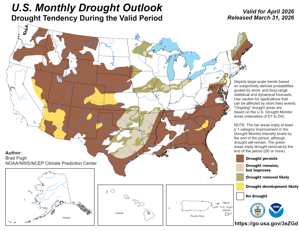
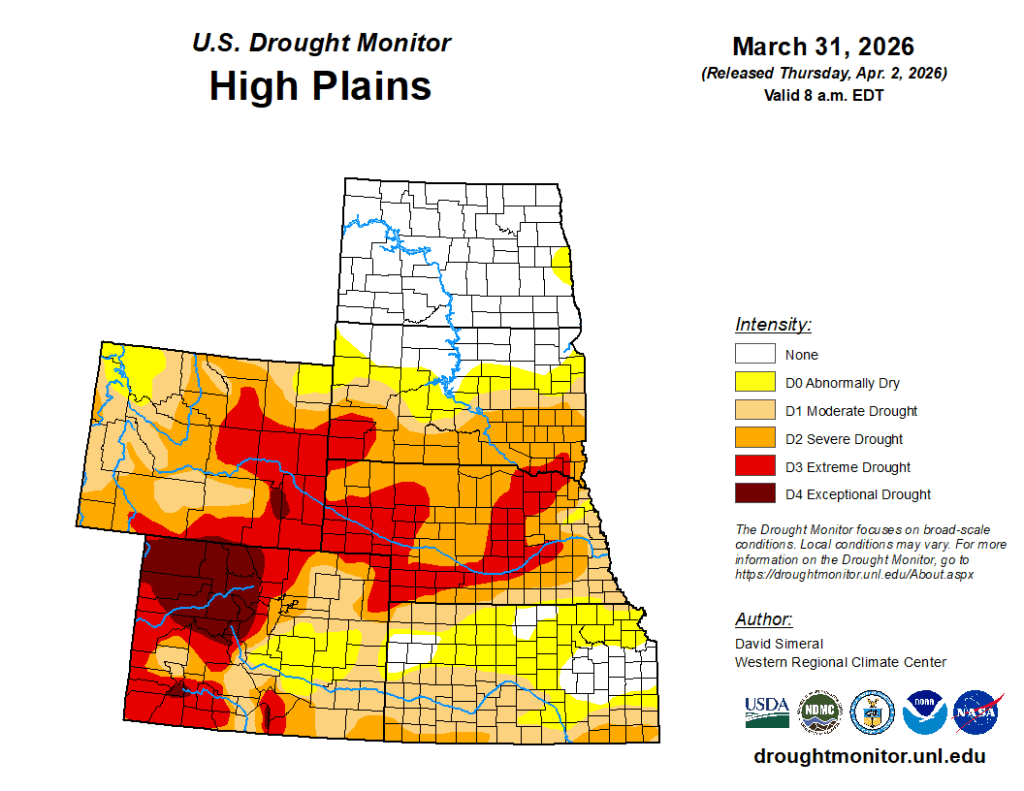
This U.S. Drought Monitor (USDM) week saw extensive degradations across areas of the West, Plains, South, and Southeast. Out West, widespread degradations were centered across the Intermountain West, including Colorado, Utah, Idaho, and Wyoming, and to a lesser extent across portions of Arizona, New Mexico, Nevada, and Montana. Continued degradation is expected in the coming weeks and months due to anomalous heat and record-low snowpack. In the Plains, drought expanded and intensified from Oklahoma to South Dakota.
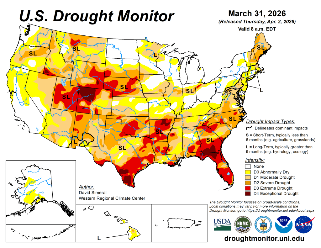
In the South and Southeast, dry conditions persisted this week, adding to significant longer-term (9- to 12+ month) precipitation deficits (ranging from 8 to 20+ inches), with the most severe drought conditions centered over portions of Texas, Arkansas, Georgia, and Florida. In the Northeast and Midwest, light-to-moderate rainfall (1 to 3 inches) during the past week led to targeted improvements in Illinois, Indiana, Ohio, Pennsylvania, and New York.
At the end of March, mountain snowpack conditions remain well below normal for the time of year, with record to near-record low levels observed across all western states. Additionally, many Natural Resources Conservation Service (NRCS) SNOw TELemetry (SNOTEL) network monitoring stations are reporting very shallow snow depths or no snow on the ground. Region-level (2-digit HUC) snow water equivalent (SWE) values (percent of median) are as follows: Pacific Northwest 55%, Missouri 56%, Upper Colorado 24%, Great Basin 18%, Lower Colorado 14%, Rio Grande 8%, and Arkansas-White-Red 8%. In California, statewide snowpack is 18% of normal (April 1), with the Southern Sierra at 32%, the Central Sierra at 21%, and the Northern Sierra at 6%. Despite poor snowpack conditions, California’s reservoirs remain at or above historical averages for the date (March 31), with Lake Shasta and Lake Oroville at 113% and 123% of average, respectively.
In the Southwest, the U.S. Bureau of Reclamation (March 29) reports critically low levels at Lake Powell (24% full; 41% of average for the date) and Lake Mead (33% full; 52% of average for the date), with the total Colorado River system at 36% of capacity (compared to 41% at the same time last year).
The West
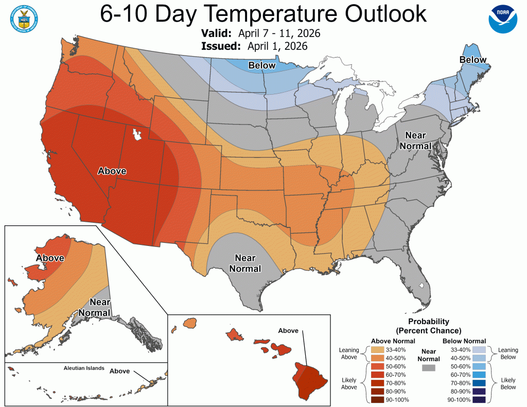
Conditions deteriorated significantly on the map this week due to a combination of record-to-near-record heat and very poor snowpack
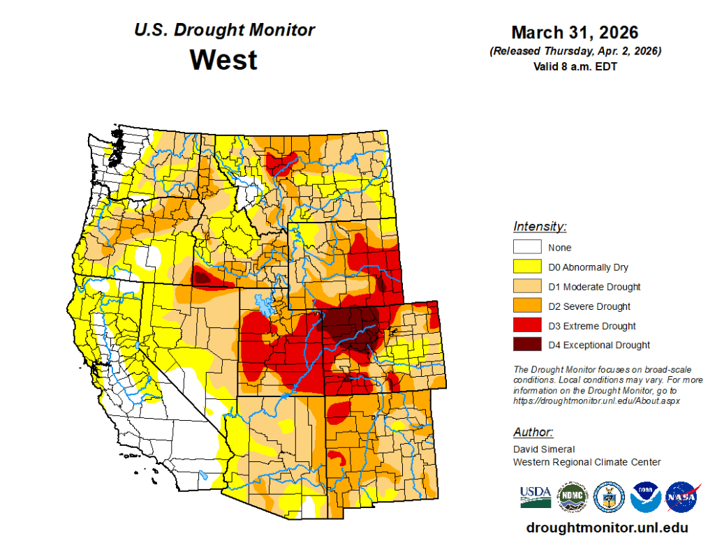
The recent heat wave accelerated snowmelt across the region over the past few weeks, with many NRCS SNOTEL stations reporting little to no snow on the ground or unseasonably low levels. Peak runoff is occurring earlier than normal—or has already passed in some locations—raising concerns about reduced inflows into reservoirs moving through spring and into the summer months.
In the Upper Colorado River Basin, Lake Powell is 25% full, while upstream reservoirs show mixed conditions, including Flaming Gorge (82% full), Blue Mesa (50%), and Navajo Lake (62%). In the Rio Grande Basin in New Mexico, Elephant Butte is 12% full, and Caballo Reservoir is 7% full. In Arizona, the Salt River Project reports the Salt River system at 56% full, the Verde system at 63%, and the combined system at 63% (compared to 70% last year).
The High Plains
There was no report for the High Plains region.
The South
On this week’s map, widespread degradations were made in drought-affected areas of Texas, Oklahoma, Louisiana, and Arkansas, while isolated areas of Mississippi and Tennessee saw degradations.

During the past 30-day period, the National Drought Mitigation Center’s Conditions Monitoring Observer Reports tool showed numerous impact reports across the region. For the week, dry conditions prevailed across the region. Looking at climatological rankings for the past 90-day period (December 31 to March 31), several locations ranked among their driest on record, including Austin, TX (4th driest; -5.53 inches), Brownsville, TX (driest on record; -3.38 inches), Oklahoma City, OK (driest on record; -3.61 inches), Monticello, AR (driest on record; -8.95 inches), and Jackson, MS (driest on record; -7.4 inches). In Texas, Water for Texas (April 1) reports statewide reservoirs at 73.5% full, with eastern reservoirs in good condition, while many western and southern reservoirs remain below normal, including Falcon Reservoir (19% full). — UNL Drought Monitor