Nationwide
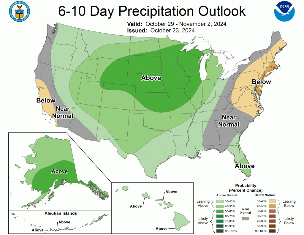
Precipitation fell across much of the U.S. over the past week, while heavier amounts were observed over parts of the Pacific Northwest and Southwest.
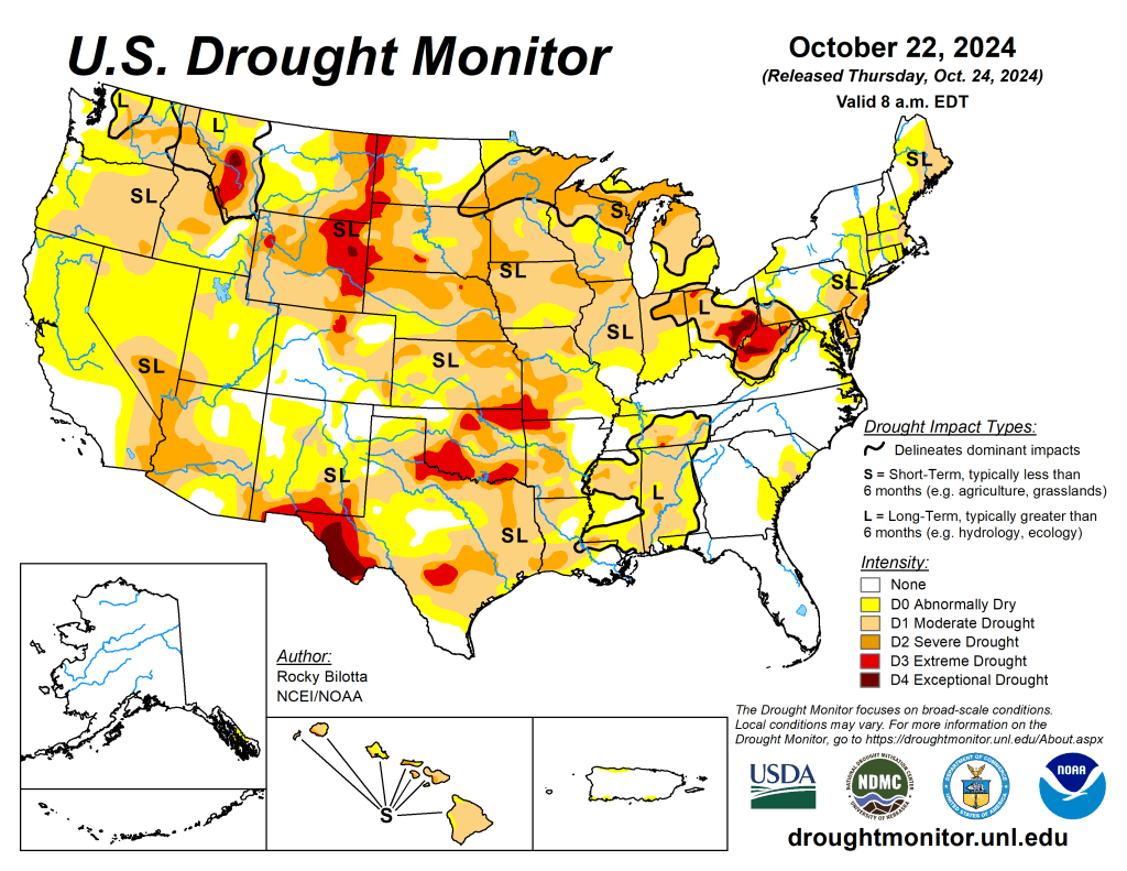
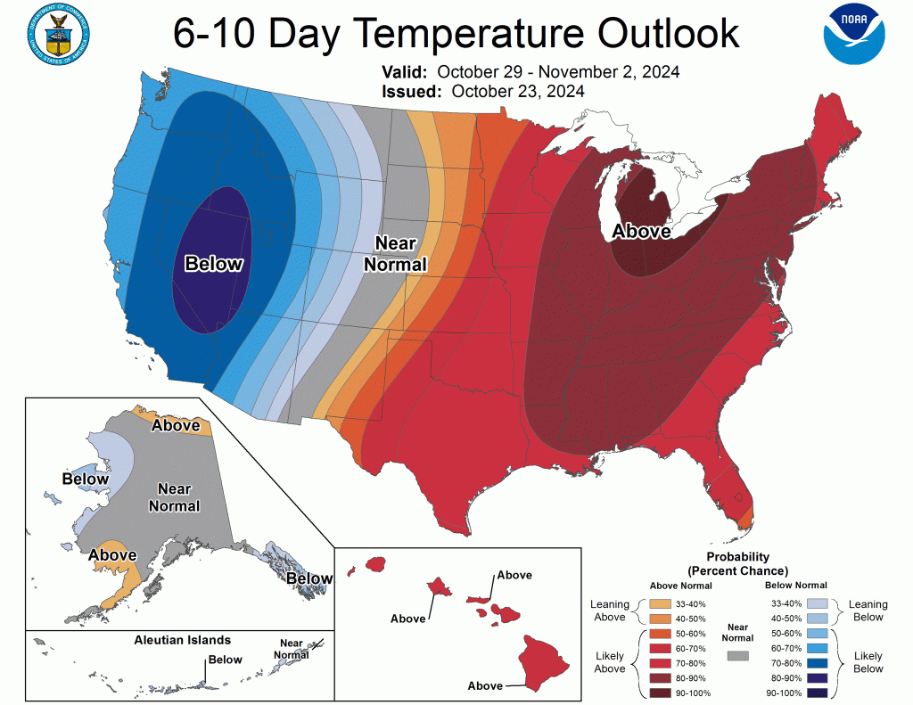
Portions of New Mexico, Utah, Colorado and Washington reported rainfall totals between 3-5 inches above normal, while precipitation totals were below normal across much of the eastern U.S. Warmer-than-normal temperatures were observed across much of the U.S. this week. Temperature departures ranging between 6-15 F above normal were observed from the northern Rockies to northern portions of the Midwest. Cooler-than-normal temperatures were observed from eastern portions of Texas to the Mid-Atlantic and in parts of the Great Bains and Southwest. The Southeast observed temperatures between 3-9 F below normal this week.
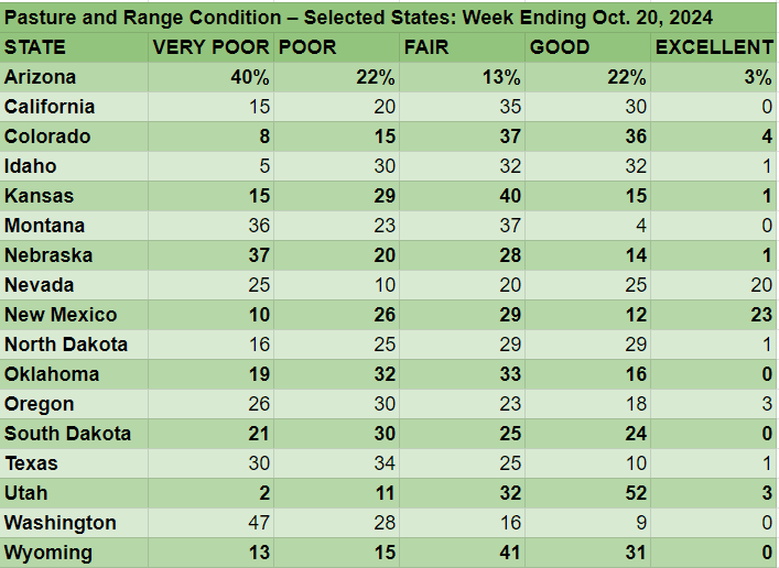
The West
This week, average temperatures were mostly above normal across the West, while much of the Great Basin, New Mexico, and southern California experienced below-normal temperatures, with departures of 1-6 F below normal.
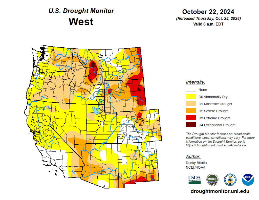
Conversely, Montana observed temperatures ranging between 3-12 F above normal this week. Precipitation fell across much of the region, but amounts were mostly normal to below-normal. Heavier rainfall totals, up to 600% above normal, were observed over parts of northwest Washington, Utah and New Mexico. Daily maximum precipitation records were set in parts of Utah and New Mexico.
Above-normal precipitation (up to 8 inches above normal), along with cooler temperatures, improved drought and abnormal dryness in New Mexico. In contrast, abnormal dryness improved in Arizona, Utah, and Washington. Warmer temperatures and below-normal precipitation resulted in an expansion of moderate to extreme drought and abnormal dryness in eastern Montana based on Standardized Precipitation Index (SPI)/Standardized Precipitation Evapotranspiration Index (SPEI) data, as well as low soil moisture and streamflow values.
The High Plains
Warm temperature dominated the High Plains this week, with departures ranging up to 12 F above normal, especially in the northern portions of the region.
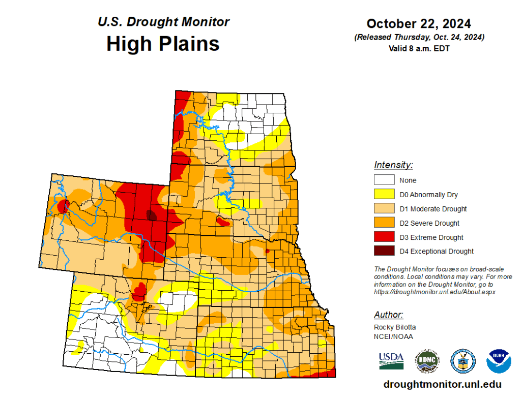
Precipitation fell across much of the region this week, but amounts were not large enough to prevent further degradations across much of the region. Extreme drought was introduced in northeast Nebraska, while extreme drought was expanded in western South Dakota, eastern Wyoming, and northwestern Nebraska. Severe and moderate drought were expanded in portions of Kansas, Nebraska, and the Dakotas, while severe drought was expanded in southern Wyoming. Abnormal dryness was expanded in parts of North Dakota. The heaviest rains fell across Colorado, reporting rainfall totals up to 600% of normal, resulting in improvements of moderate to severe drought and abnormal dryness in western and southern portions of the state this week.
The South
Dry conditions continued across much of the South this week, while precipitation fell just along the western borders of Texas, Oklahoma and Kansas.
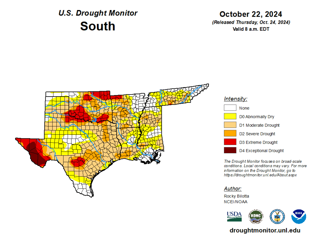
Temperatures were mixed across the region. The eastern areas experienced below-normal temperatures, with departures of 1-9 F below normal, while above-normal temperatures were observed across western portions of the South, with departures of 1-6 F above normal. Moderate to severe drought was expanded across portions of Texas, Oklahoma, and northern Arkansas, while moderate to severe drought was expanded in Louisiana and Mississippi. The expansion and intensification of drought categories were based on short-term SPI/SPEI, reservoir levels, streamflow and soil moisture data. — UNL Drought Monitor