Nationwide
The wet May pattern continued to alleviate or bring an end to drought across the Northeast. Severe to extreme drought persists in central to south Florida, although locally heavy showers have fallen across the east-central Florida Peninsula as the rainy season begins to ramp up.

Widespread precipitation (2 inches or more) contributed to improvements in the Central and Southern Great Plains. During recent weeks, drought developed across portions of southwestern Iowa, northern Illinois, and northwestern Indiana. A short-term drought expanded across the Pacific Northwest and intensified in southern Utah and northwestern Colorado during mid-to-late May.

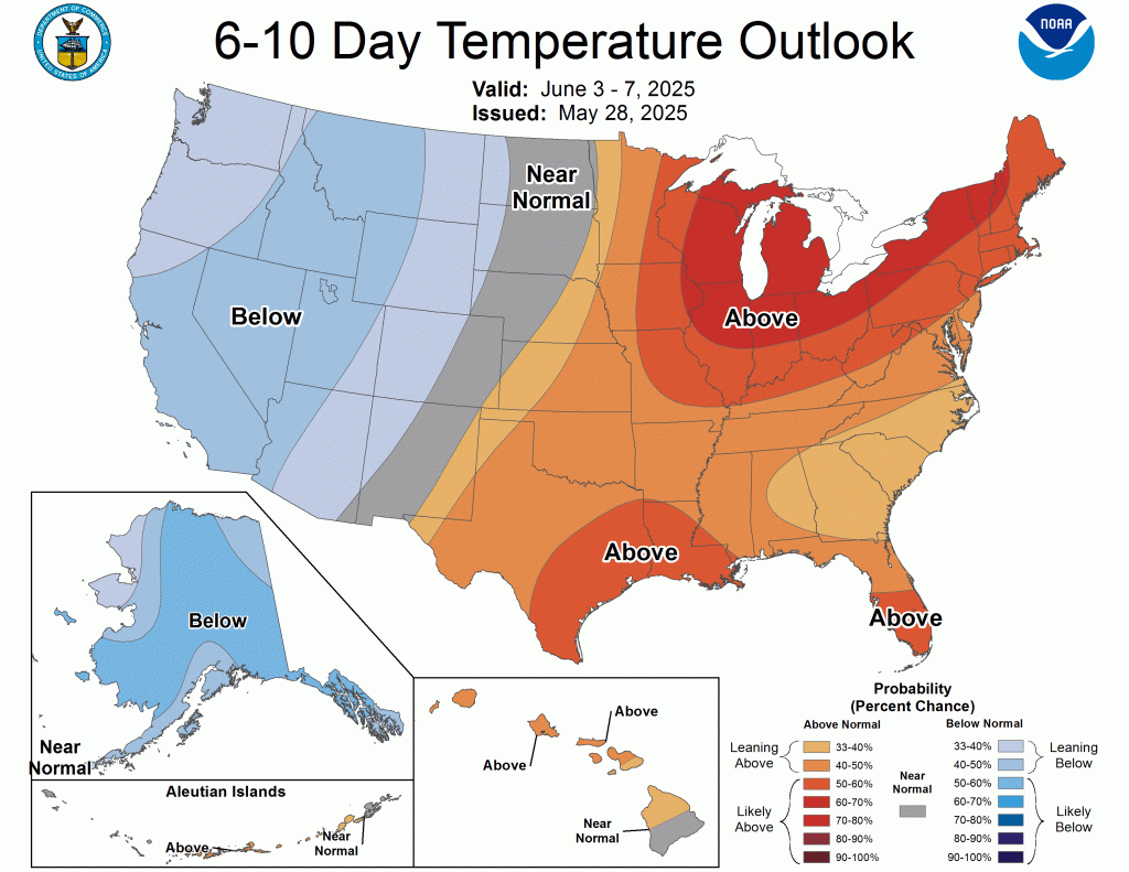
From May 20-26, above-normal temperatures were limited to the southern tier of the contiguous U.S. 7-day temperatures averaged 4 to 10 degrees F below normal across the Northeast, Corn Belt, and Northern to Central Great Plains.
The West
Based on the 6-month SPI, water-year-to-date (October 1, 2024, to May 26, 2025) precipitation deficits, and a 28-day average streamflow, the moderate drought (D1) was expanded to include more of southwestern Washington.

Increasing 30 to 90-day precipitation deficits, low 28-day average streamflows, and declining soil moisture led to the introduction of D1 to parts of northwestern and northeastern Oregon. The 6-month Standardized Precipitation Index (SPI) supported the expansion of severe drought (D2) coverage across southwestern Utah. Although precipitation was light this past week, SPIs dating back 120 days, along with more favorable soil moisture indicators, led to improvements across southwestern and eastern Montana. Conversely, in northwest Montana, D1 was degraded to D2 based on a 120-day SPI and declining soil moisture. To the east of the Sierra Nevada Mountains, abnormal dryness (D0) has expanded south of Lake Tahoe due to drier-than-normal conditions since April.
The High Plains
From May 24-26, widespread precipitation (1 to 3 inches, locally more) resulted in a 1-category improvement to portions of southwestern South Dakota, Nebraska, Kansas, and northeastern Colorado.

Much cooler temperatures accompanied this widespread precipitation, which contributed to the recharge of topsoil moisture. Based on multiple indicators, including the SPI at various time scales and soil moisture, the coverage of severe (D2) to extreme (D3) drought was reduced across central to western Nebraska, along with adjacent areas of southwestern South Dakota. Although precipitation was lighter across southeastern Colorado, SPIs at multiple time scales, soil moisture, and VegDri no longer support any D1. Southern Nebraska and northern Kansas missed out on this past week’s precipitation, and a couple of small 1-category degradations were made. A 1-category degradation was also warranted for western Colorado, based on a 90- to 180-day SPI.
The South
Heavy rainfall (2 inches or more) prompted a 1-category improvement to ongoing drought areas of south-central and southeastern Texas.
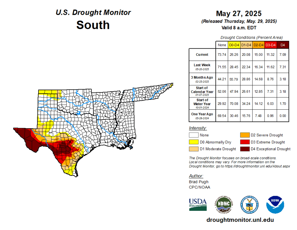
Despite this recent heavy rainfall, levels in the long-term monitoring wells of Bexar and Medina Counties remain at all-time lows. Additionally, many of the 28-day average USGS streamflows are below the 5th percentile, which supports the D3-D4 depiction. Since the SPIs dating back 6 months are neutral, and considering the major impact is hydrological, the drought impact was changed to long-term only. With drought improvement for northwestern Oklahoma this past week, nearly all of Oklahoma and northern to eastern Texas are drought-free. The Lower Mississippi Valley and Tennessee Valley are also drought-free with surplus 30 to 90-day precipitation. — UNL Drought Monitor