Nationwide
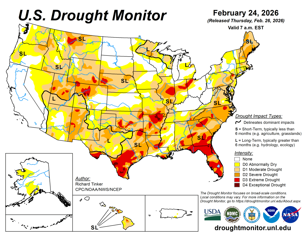
Stormy, briefly colder weather in California and elsewhere in the West helped to improve previously meager mountain snowpack, with an average of approximately 6 inches of snow-water equivalency being added to the Sierra Nevada. However, 4- to 8-foot snowfall totals in the Sierra Nevada also led to travel disruptions through mountain passes and contributed to the nation’s deadliest avalanche in 45 years, northwest of Lake Tahoe.
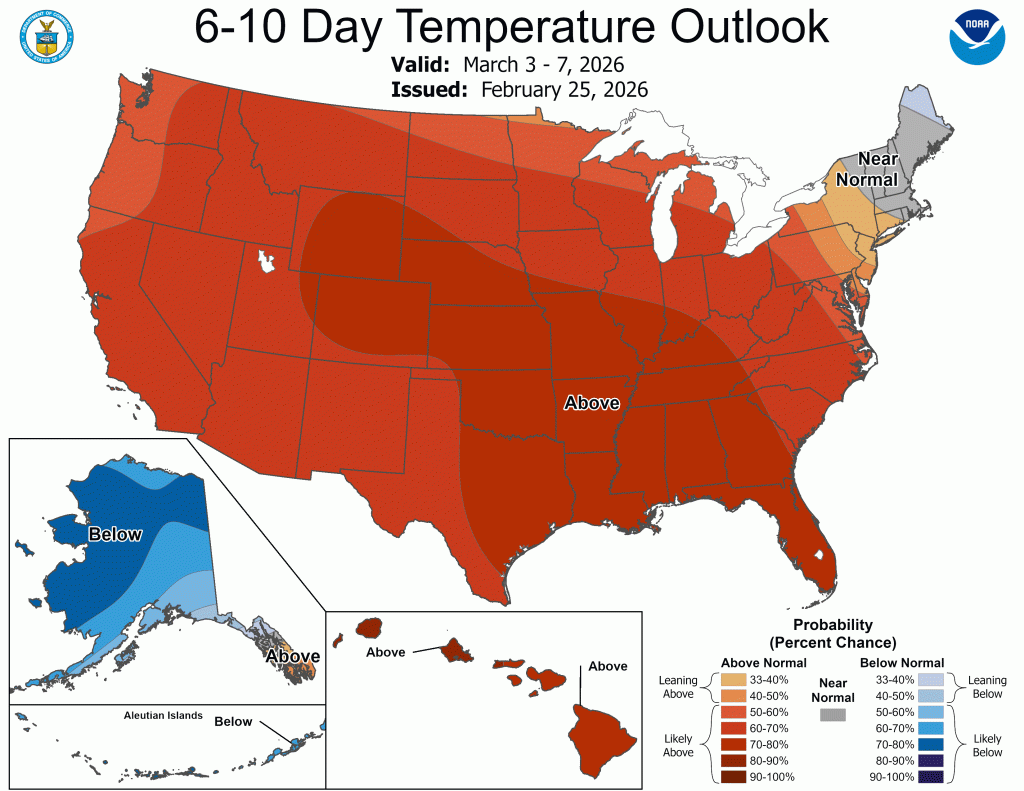
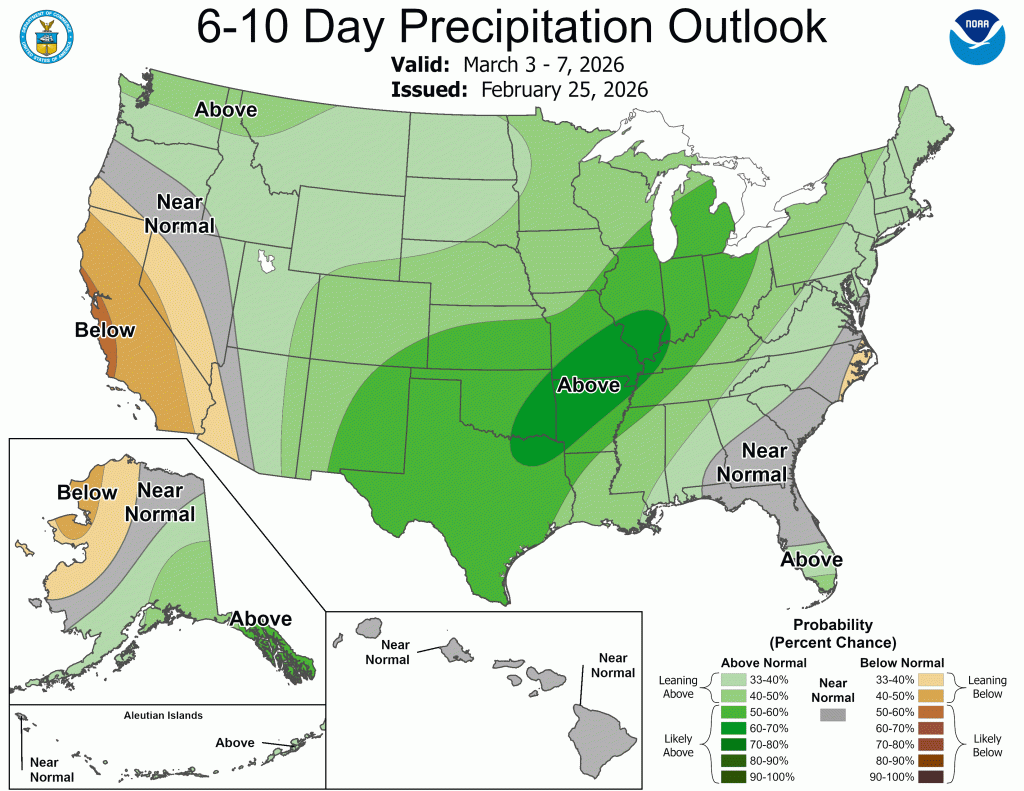
Meanwhile, the nation’s mid-section faced several days with record-setting warmth and gusty winds. Portions of the central and southern High Plains endured a rash of wildfires, starting on February 17, with the largest—the Ranger Road Fire—quickly consuming more than 280,000 acres of cured vegetation in northwestern Oklahoma and southwestern Kansas. Initial reports indicated that there were also livestock losses and property destruction.
In contrast, several rounds of storminess affected the eastern U.S., culminating in a late-winter blizzard along the middle and northern Atlantic Coast on February 22-23. The winter storm deposited more than a foot of snow in major East Coast cities from Philadelphia to Boston, with a single-storm record of 37.9 inches measured in Providence, Rhode Island. Earlier, an early-season outbreak of severe weather occurred on February 19, when as many as a dozen tornadoes were reported in Illinois and Indiana.
The West
There were a few overall changes in the West, as most of the heavy precipitation fell in areas—such as northern and central California—currently experiencing no drought. Farther inland, brief bursts of precipitation in drought-affected areas prevented conditions from worsening but provided little overall relief.
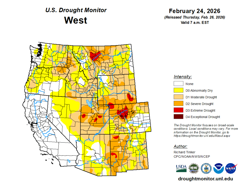
In Utah’s Wasatch Range, Alta received 31.2 inches of snow in a 24-hour period on February 17-18, but will likely end the month with below-average snowfall. Below-average snow-water equivalency remains a concern in much of the West, even in drought-free areas such as the Sierra Nevada. According to the California Department of Water Resources, the Sierra Nevada snowpack contained an average snow-water equivalency of 16 inches—up about 6 inches from earlier in the month, but less than three-quarters of normal for late February. In much of Arizona, New Mexico, and Oregon, snow-water equivalency values were less than 50% of normal.
The High Plains
A gradual deterioration in drought conditions was noted in several areas, except North Dakota, which remains free of drought.
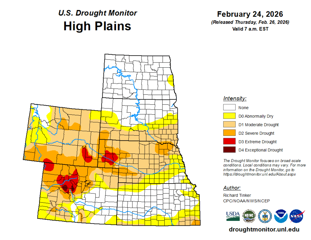
In Nebraska, a mostly dry, windy winter has adversely affected winter wheat, which at the end of January was rated just 24% in good to excellent condition—down from 54% in late-November 2025. The snowfall that blanketed parts of Nebraska on February 19 provided only temporary relief from the overall dryness. Farther south, parts of Kansas and Colorado experienced high winds, grass fires, and blowing dust, especially on February 17. On that date, wind gusts in Colorado were clocked to 79 mph in Colorado Springs, 72 mph in Burlington, and 71 mph in Pueblo. South of Pueblo, on I-25, chain reaction collisions due to low visibility in blowing dust resulted in five fatalities and involved approximately three dozen vehicles.
The South
The southern High Plains endured a historic day of wind and wildfires on February 17, when the Ranger Road Fire was ignited in Beaver County, OK.
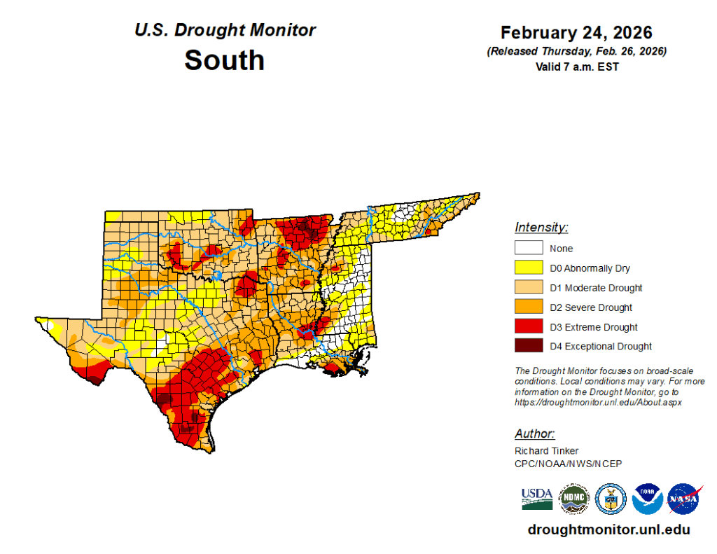
The Ranger Road Fire soon scorched more than 280,000 acres of grass and brush, expanding into northwestern Harper County, OK, and parts of three counties in southwestern Kansas. Meanwhile, the Lavender Fire burned more than 18,000 acres northeast of Vega, TX, and reportedly destroyed at least 18 structures. On February 17, the day of ignition, peak gusts included 73 mph in Lubbock, TX, and 67 mph in Guymon, OK. Due to deteriorating conditions and diminishing topsoil moisture reserves, moderate drought (D1) was broadly introduced across northern and western Oklahoma and the northern panhandle of Texas. Farther east, gradually worsening drought conditions were also observed from the western Gulf Coast region to the Mississippi Delta, with several new areas of extreme drought (D3) being introduced and others being expanded. Coverage of exceptional drought (D4) increased slightly in southern Texas. — UNL Drought Monitor